
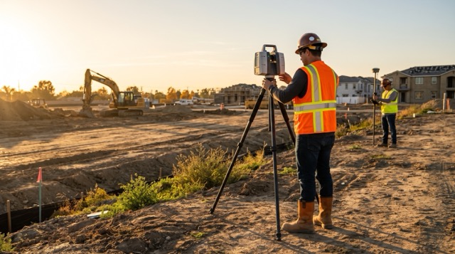
The transition from late summer to autumn is a double-edged sword for the construction and surveying industries. On one hand, the oppressive heat of July and August finally breaks, making long hours in the field significantly more comfortable for your crews. On the other hand, a much more rigid constraint begins to tighten its grip: shorter days.
As we move deeper into October, the sun dips below the horizon earlier every week. Yet, project schedules, year-end construction milestones, and Q4 budget allocations don’t adjust for the changing seasons. Clients still expect their as-builts, topographic maps, and layout stakes delivered on the exact same timeline as they did in mid-June when you had 14 hours of usable sunlight.
When your survey crews have less time in the field to capture necessary data, the only way to maintain your margins and keep projects on track is to change how you capture that data. If your team is still relying solely on traditional, manual workflows, you are likely feeling the autumn crunch.
Here is how adopting faster, advanced reality capture technology—like 3D laser scanning, robotic total stations, and modern GNSS equipment—allows your crews to capture massive amounts of site data in a fraction of the time, ensuring you beat the sunset and stay ahead of schedule.
The True Cost of Chasing Daylight
Before looking at the solutions, it is important to understand the compounding costs of running out of daylight. Traditional surveying methods require a line of sight, reliable ambient light, and often a two-person crew. As the afternoon shadows grow longer, visibility drops, making it harder to spot prisms, read stakes, or navigate complex, uneven terrain safely.
When a crew is forced to pack up at 5:00 PM with only 10% of the site left to shoot, the costs skyrocket. You aren’t just losing an hour of work; you are paying for the demobilization, the drive time back to the office, the drive time back to the site the next morning, and the setup time to re-establish control—all just to capture a handful of remaining points.
Furthermore, the pressure to finish before dark often leads to rushed work. Rushed work leads to missed features, requiring costly “go-backs” that eat directly into your firm’s profitability. To survive the fall shorter days, crews need to maximize every minute they are on the site.
Doing More With Shorter Days: The Power of 3D Laser Scanning
When time is of the essence, nothing beats the speed and comprehensive coverage of a 3D laser scanner.
If you are tasked with capturing an existing structure, a complex intersection, or an intricate MEP (mechanical, electrical, and plumbing) installation, shooting it point-by-point with a traditional total station can take days. A modern 3D laser scanner, such as the FARO Focus Premium or FARO Focus Core, can capture the exact same environment in a matter of hours, if not minutes.
More importantly, LiDAR (Light Detection and Ranging) is an active sensor technology. Unlike photogrammetry, which relies entirely on ambient sunlight to capture usable images, a 3D laser scanner emits its own light pulses. It doesn’t care if it is 2:00 PM under a bright sun, or 6:30 PM in the deep dusk. The scanner will reliably capture millions of data points per second with millimeter accuracy, regardless of the fading daylight.
By utilizing 3D scanning, your crews only need to walk the site once. They capture everything—the topography, the structures, the utilities, the overhead clearances—in high-density point clouds. This “capture everything now, extract what you need later” workflow means that your drafting and engineering teams back in the office have a complete digital twin of the site. Even if the client changes the scope of work a week later, you won’t need to send a crew back out into the cold; the data is already in your system.
Maximizing Labor with GNSS and Robotics
For heavy civil, boundary work, and construction layout, 3D scanning might not be the primary tool. Instead, the focus shifts to moving fast and reducing the headcount required to shoot a site.
This is where robotic total stations and advanced GNSS/RTK rovers become essential. Modern robotic total stations, like the Topcon MS series, feature advanced automated matrix detection and target acquisition. The instrument actively searches for and locks onto the prism, eliminating the need for an operator to squint through a lens in low-light conditions. A single surveyor can operate the rod, moving rapidly from point to point, effectively doubling your labor efficiency.
Similarly, advanced GNSS systems like the Topcon HiPer VR are built to keep crews moving. Outfitted with universal tracking technology that accesses all major satellite constellations (GPS, GLONASS, Galileo, Beidou), the HiPer VR maintains a strong fix even as the fall foliage and changing atmospheric conditions threaten signal integrity. Furthermore, with its revolutionary 9-axis IMU (Inertial Measurement Unit) and eCompass, the pole no longer needs to be perfectly plumb to get an accurate shot. Surveyors can capture points on the fly, tilt the rod to reach under parked equipment or fences, and move on instantly. Saving just ten seconds per point equates to hours of saved time over a large topographic survey.
Expanding the Horizon with Aerial Drones
While terrestrial scanning and GNSS handle the ground game, UAVs (drones) have revolutionized massive site topography. For large-acreage boundary surveys, volume calculations for earthmoving, or massive commercial developments, drones equipped with photogrammetry or aerial LiDAR payloads can map hundreds of acres in a single 30-minute flight.
Deploying a drone right after morning meetings ensures that by lunchtime, millions of data points are already processing in the cloud. It is the ultimate tool for beating the clock and the setting sun, turning what used to be a week-long field assignment into a half-day operation.
Don’t Just Buy—Equip, Calibrate, and Train Before the Rush
Upgrading to faster technology is the best way to combat the shrinking autumn daylight, but introducing new gear to a crew mid-project can cause its own delays if not handled correctly.
At Topo Element, we know that you don’t have time for guesswork. We aren’t just an equipment supplier; we are your field-tested partner. We understand that jumping from traditional layout to 3D laser scanning or robotic GNSS requires support. That is why we offer comprehensive, one-on-one demos right on your jobsite, ensuring the gear fits your specific workflow before you commit.
If you are facing a massive Q4 push and need extra firepower just to get through the season, our rental fleet of maintained, calibrated total stations, GPS receivers, and 3D scanners is ready to deploy. And if you are bringing your existing gear out of the truck for the fall, remember that unpredictable autumn weather demands equipment that seals out moisture and dust. Our service center offers precise ISO-standard calibrations and internal cleaning to ensure your gear is tracking perfectly when you need it most.
Looking Ahead to the Q4 Push
The fall brings shorter days, but your deadlines aren’t moving. As the industry races to close out projects before the end of the year, the contractors and surveyors who embrace rapid data capture will be the ones who stay profitable, safe, and on schedule.
Stop racing the sunset. Equip your crews with the tools they need to do more in less time. Reach out to the Topo Element team today to schedule a demo or reserve a rental, and let’s keep your job moving forward without compromise.